
Tracking Stalled Storms Like Hurricane Harvey
Post-1980 climate warming could have contributed to the extreme precipitation that fell on southeast Texas during 26–29 August 2017 by approximately 20%, with an interquartile range of 13%–37%
While the Gulf Coast is no stranger to strong hurricanes, any tropical cyclone that stalls for days over a major metropolitan area and results in excessive rainfall is a recipe for disaster. Quantitative attribution conducted by downscaling simulations by removing the climate trends from the initial and boundary conditions, with further analyses of similarly stalled storms like the Louisiana flooding event, signifies an increasing trend in the number of cases that have similar synoptic patterns and associated stationarity to that of Harvey.
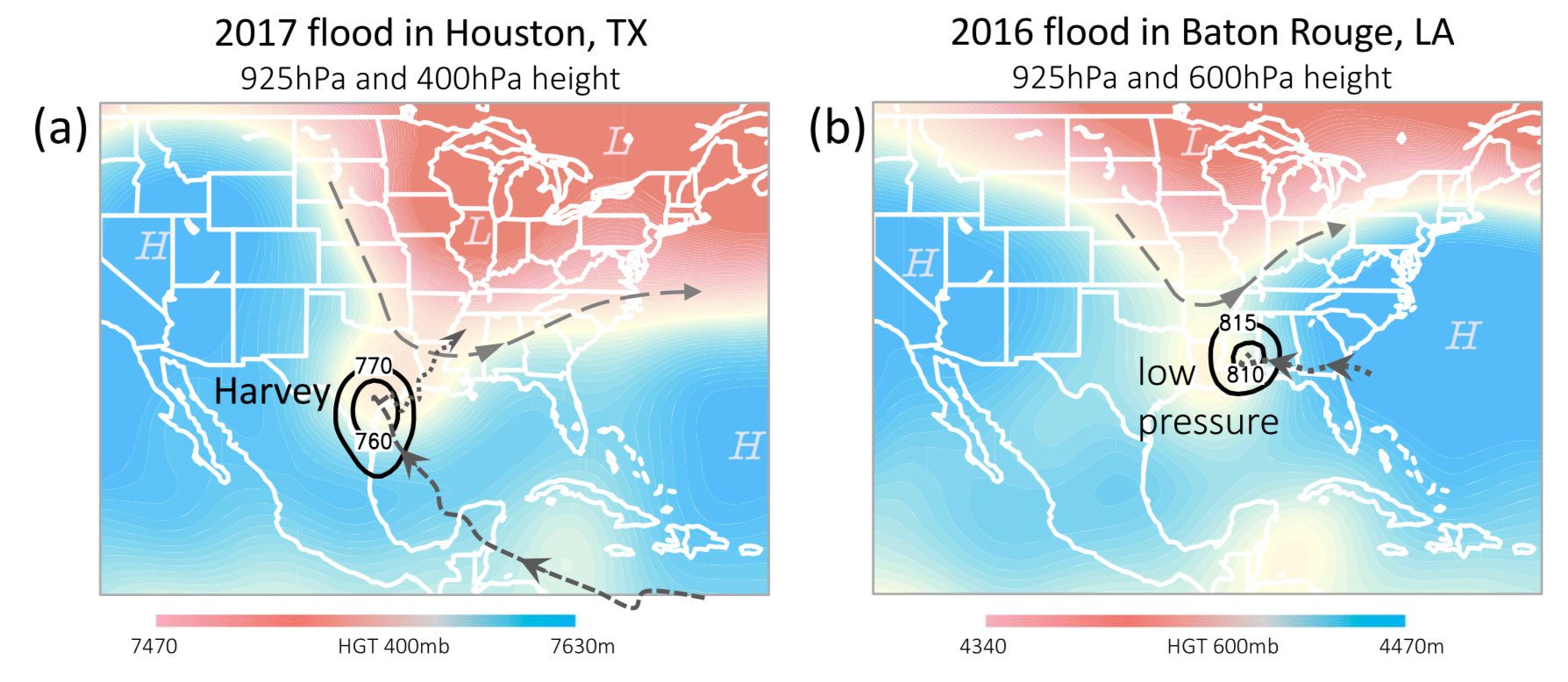
What made Harvey particularly devastating was that the storm stalled near the Texas coast and produced heavy rains for four consecutive days near Houston. The intense rainfall over several days was reminiscent of the Louisiana flood that occurred a year earlier; in that August 2016 event, a stalled low-pressure system produced four days of intense rainfall that devastated the city of Baton Rouge. The two events bear a striking resemblance, not in the storm category but rather, in the time of year that they occurred (August) as well as in their geographical location (neighboring states and near-coastal cities). Both systems had stalled due to blocking high pressure that prevented movement further inland followed by interactions with a frontal system to the north. Preliminary earth system modeling tracking and projecting stalled storms over southwest Texas, in conjunction with approaching northern frontal systems, signifies an increasing trend in the number of cases that have similar synoptic patterns and associated stationarity to that of Harvey. Precipitation associated with these stalled storms was projected to increase due to increased precipitable water. While the estimate from the present downscaling attribution is by no means absolute, since attributing convectively-driven extreme precipitation events is challenging, this study calls for a careful reevaluation of the attribution of convective systems that may become more stalled in the future and produce more rainfall.