
An AGU23 Town Hall Takes on Modeling Extreme Events
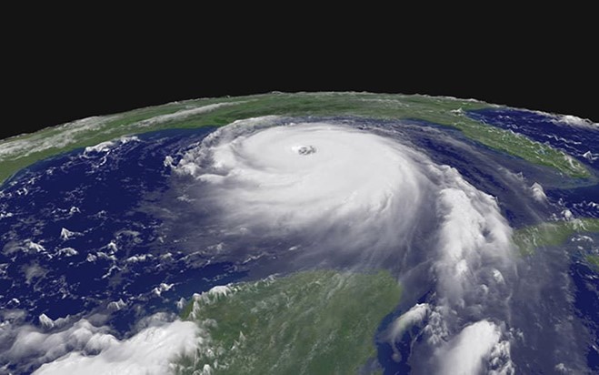
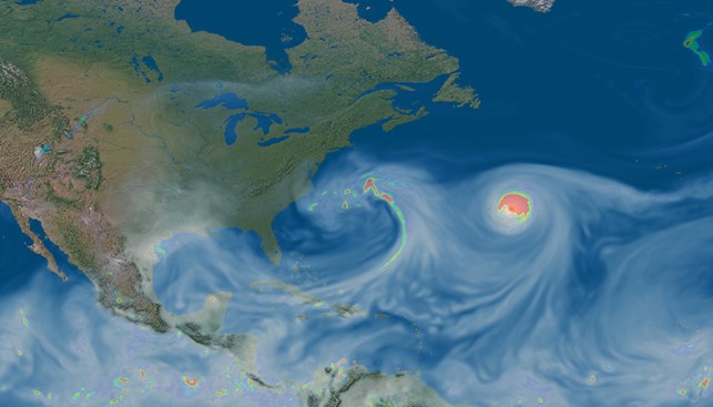
Extreme events cause most of the world’s weather-related damage to natural and human systems. Improving our ability to predict such events, their variability, future changes, and what their impacts might be, is of great national importance.
The U.S. Department of Energy (DOE) supports modeling and research of extreme events. That was the focus of a town hall during the 2023 Fall Meeting of the American Geophysical Union (AGU). In the spotlight were advances in Earth system models spanning scales ranging from climate to weather and systems ranging from natural to multisectoral, socioeconomic, and built environments.
DOE has “a large and diverse portfolio” in modeling extreme events, says Renu Joseph, the town hall’s primary convenor. Despite the evening’s 6:30 p.m. start time, the event attracted more than 70 in-person attendees.
In DOE’s Earth and Environmental Systems Modeling (EESM) program, three components are at the heart of extreme-0events modeling efforts and related open-science research.
One of them is the Regional and Global Model Analysis (RGMA) program area, where Joseph is the Program Manager. Multisector Dynamics (MSD) is directed by Program Manager Bob Vallario. Earth System Model Development (ESMD) is directed by Program Manager Xujing Davis.
Vallario pointed to the difficulty of developing predictive models for the interacting systems, sectors, and scales involved in simulating how extreme events affect both natural and human systems.
The goal of ESMD is to support the development of the DOE’s flagship Earth System Model, the Energy Exascale Earth System Model (E3SM). Davis provided an overview of the ESMD portfolio on how E3SM development is supported. She also highlighted major E3SM progress in advancing foundational modeling capabilities in simulating extreme events.
Davis led another town hall at AGU23, “E3SM: A Decade of Earth System Modeling Effort at the Department of Energy."
‘The Tougher Problems’
The three EESM program managers and other town hall presenters detailed a range of modeling efforts. During the hour, they provided insights into machine learning and artificial intelligence techniques, faster computers, and models that achieve finer-scale details (higher resolution) made possible by DOE-supported advances.
Modeling high-impact events in a changing climate system in a holistic way requires institutional courage, says DOE’s Gerald “Gary” Geernaert. “We take on some of the tougher problems.”
Geernaert directs DOE’s Earth and Environmental System Sciences Division (EESSD), which includes all three components of EESM.
One EESM mission, he says, is to support the basic science behind developing, evaluating, and refining simulations of extreme events.
Geernaert and others throughout the town hall repeated a common theme: the need for simulating the effects of extreme events on both natural systems and human communities.
Pursuing Uncertainties
Under Joseph’s direction, RGMA researchers have formed university partnerships, science focus areas, and cooperative agreements. They pursue ways to reduce the uncertainties that are part of Earth system models by investigating processes and feedbacks within clouds, the Earth’s biogeochemical cycles, and rapid change in the high latitudes.
Other RGMA efforts investigate decadal climate and weather predictability, what drives extreme events, and water-cycle processes that influence “hydrologic extremes”—what non-scientists call damaging rains and snow.
Extreme events get top billing, says Joseph. She outlined over 10 years of funding requests for research aimed at understanding, evaluating, and simulating such catastrophic weather phenomena.
The Challenge of Interacting Earth Systems
During his presentation, Vallario emphasized the impacts of extreme weather on ecosystems and human communities.
He says such events──and the responses they require──have engendered an uptick in inter- and intra-agency collaborations. That means more opportunities to engage: another theme of the AGU town hall.
Vallario says MSD’s “community of practice” means connecting MSD research to operations, human-systems modeling, energy transitions, early-career development, and, most of all, “taming the beast of uncertainty.”
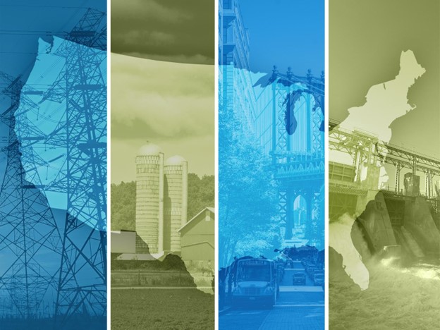
Jennie Rice, an earth scientist at Pacific Northwest National Laboratory (PNNL), provided a glimpse of the kind of work within MSD. She is the principal investigator for a DOE science focus area called Integrated Multisector, Multiscale Modeling (IM3), which focuses on coupling models that relate to vulnerability and resilience across various scales, from local to continental.
The science of “complex, adaptive human-Earth systems,” as Rice calls it, requires open-science tools to create accurate simulations of extreme events, tipping points, uncertainties, and adaptive strategies. (AGU23’s motto was “Wide. Open. Science.”)
History, Heat Waves, and Models
IM3 research concerns only the continental United States. But Rice allowed that the lessons it delivers could be replicated globally to simulate how the impacts of extreme events ripple like waves through energy, water, land, and urban systems.
Along with lead author Andrew Jones of Lawrence Berkeley National Laboratory (LLNL), Rice coauthored a September 2023 paper in Nature Scientific Data on climate projections for the continental United States. Based in part on historical averages played forward into the late 21st century, the authors presented four 80-year simulations of projected warming trends from 2020 through 2099.
There is a community of “experiment groups” within IM3, she says. One focuses on both urban and rural heat-stress dynamics. Other study electric grid stresses, water scarcity, and combined heat-grid-and-water scarcity dynamics.
Interests among IM3 researchers are broad, understandably. They encompass climate, heat waves, drought, population, urbanization, and even gross domestic product. Researchers study regional electric grids as well as watersheds and cities. IM3’s page on integrated modeling displays research directions spanning land use, energy performance, river transport, and storm-impact simulations.
‘Replaying the Future’
Rice pointed to a collaboration between IM3 and HyperFACETS, an 11-institution project directed by both RGMA and MSD. Its mission is to create credible, understandable, and useful regional climate information for decision-makers. Jones is supported through the HyperFACETS project.
The IM3-HyperFACETS collaboration is an example of what town hall presenter Ruby Leung, a Battelle Fellow at PNNL, called “actionable science.”
E3SM and its ‘Exascale Vision’
The goal of E3SM is to advance actionable science in support of DOE’s energy mission.
To provide actionable science, E3SM features:
- Multi-resolution capabilities and improved process representations to enhance model fidelity
- Representations of human-Earth interactions to support scenario-based modeling
- And ensemble modeling to quantify simulation and projection uncertainties.
E3SM’s science is organized around three simulation campaigns based on science drivers: water cycle changes and impacts, human-Earth system feedbacks, and polar processes, sea-level rise, and coastal impacts.
Each campaign employs model configurations optimized to address associated research challenges by featuring different model capabilities.
Davis, the E3SM program manager, presented a timeline of E3SM’s major progress and achievements starting in 2014. She says the project's original ambitious “exascale vision” began to be realized in February 2023, via the record-setting performance of the Simple Cloud-Resolving E3SM Atmosphere Model (SCREAM) on DOE’s exascale supercomputer, Frontier. This breakthrough, together with other E3SM’s capabilities, such as the regional refined model (RRM), has led to improved model simulations of extreme events.
Town hall presenter David C. Bader, principle investigator of the E3SM project and director of LLNL’s climate research program, used SCREAM as an example for exciting directions in simulating extreme events in the next generation of earth system models.
He pointed out that SCREAM is a GPU-ready and performance-portable model with the ability to leverage the fastest and most energy-efficient high performance computer in the world at DOE. The ultra-high resolution of SCREAM, enabled by the extra parallelism of graphics processing units, has produced skillful simulations of storms of all types, as well as precipitation intensity and diurnal cycle. The RRM capability of SCREAM allowed even finer resolution simulations of extreme events in regions of interest with reduced computational cost. One example is a simulation of the July-August 2023 extreme rainfall event in the Beijing-Tianjin-Hebei region of North China.
In November 2023, SCREAM won the inaugural Gordon Bell Prize for Climate Modeling for its innovative parallel computing contributions, which represent a significant step towards solving the global climate crisis.
Delivering Actionable Science
To explore a fraction of EESM-supported research, Leung delivered an overview of three projects she currently has underway. They all address understanding and modeling extreme events that have worldwide impacts.
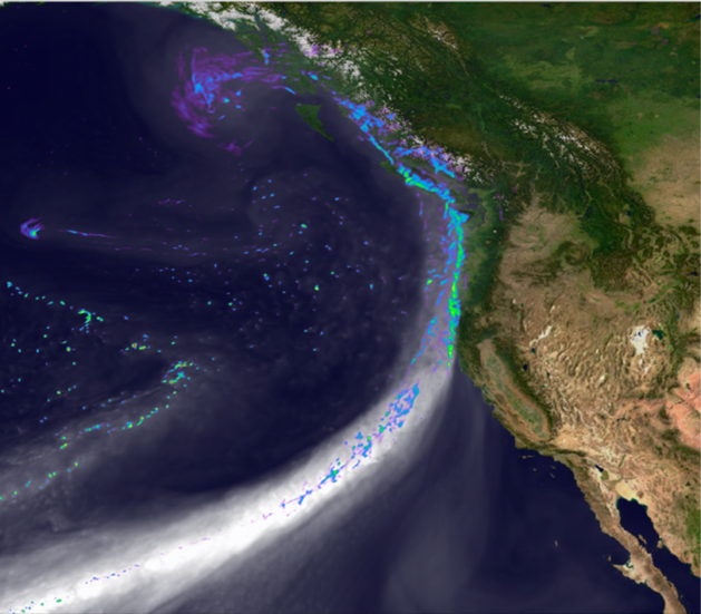
Leung is a globally recognized expert on atmospheric rivers. These water-packed narrow bands of moisture, transported poleward from the tropics, can sometimes engender extreme weather on coastal regions (as rain) or inland (as heavy snowfall in mountains). She is also the chief scientist of the E3SM project and the principal investigator for an RGMA science focus area called Water Cycle and Climate Extremes Modeling (WACCEM).
At the town hall, Leung outlined an E3SM model hierarchy of interconnected model configurations and new capabilities. The model hierarchy includes simple theoretical and idealized models, as well as synthetic models of storms like those that simulate tropical cyclones. The new capabilities include data assimilation for model-data integration and machine learning used to correct model biases.
The E3SM model hierarchy is being developed to support scientific discovery by the broad atmospheric and climate science community. For example, it will allow WACCEM scientists to delve into large-scale circulations, regional-scale (“mesoscale”) convective storms, and surface-atmosphere interactions at a variety of scales──all to better understand the predictability of extreme events.
Delivering actionable science sometimes involves framing models of atmosphere, water, land, and energy interactions by using “storylines,” another DOE innovation discussed at the town hall.
These narrative frameworks explain a pattern of past weather events and how they may unfold in the future. Storylines, along with research-centered stakeholder engagement, are core elements of the HyperFACETS project, where Leung is a lead researcher.
In all, she says, actionable science means that reliable models can inform decisionmakers on what mitigating steps to take.
For that reason, Leung added, “it’s important for us to build trust in the models.”
New Modeling Tools

Progress in modeling Earth systems was a recurring theme of the extreme events town hall.
For that reason, a discussion by William “Bill” Collins, a climate modeler and associate laboratory director at Lawrence Berkeley National Laboratory, fit right in.
Collins described DOE’s frontiers of modeling extreme events using artificial intelligence and machine learning. To illustrate, he introduced the Calibrated and Systematic Characterization, Attribution, and Detection of Extremes (CASCADE), an RGMA modeling project that confronts (among other issues) extreme events that are low-likelihood and high-impact.
For example, he described a 2022 paper by the CASCADE group on the 2021 heatwave in the Pacific Northwest that the authors called “unprecedented in the observational record” over such a wide area. The authors also warned that heatwave temperatures by the end of the 21st century could increase by around 5 degrees Celsius (41 degrees Fahrenheit).
Other members of the Collins group authored a June 2023 paper in Nature on the likely increased intensity of rainfall events in high-elevation regions of the Northern Hemisphere, marking a shift from snow to rain. That means more floods, landslides, and soil erosion. Future model projections were aided by CASCADE.
A Machine-Learning Architecture
Collins praised FourCastNet, which is short for the Fourier Forecasting Neural Network. This machine-learning architecture can generate a two-week weather forecast in half a second—faster by around four orders of magnitude than traditional models.
The Collins team also uses FourCastNet to generate what he calls HENS, or “huge ensembles” of hindcasts. (A hindcast usually involves running models based on decades of historical data.) The intent is to develop a diagnostics tool that can forecast the probabilities of extreme events.
After the formal presentations, there was a free-for-all exchange of ideas. Audience members discussed modeling extreme events at finer scales; extreme events in urban and urban-coastal environments; integrated hydrology-terrestrial modeling; and better short-term forecasts and models.
For Joseph, the conclusion was clear: “There’s a lot more to be done.”