
Building a Global Storm Database
Twenty years of data on strong thunderstorms to help inform Earth system models
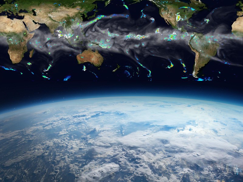
A new global database built by researchers at Pacific Northwest National Laboratory (PNNL) captures characteristics and rainfall data of strong thunderstorms from the past 20 years. Including storms in both midlatitude and tropical zones is key to capturing how contrasting storm behavior and corresponding precipitation could affect populated regions of the globe.
Mesoscale convective systems (MCSs) are a class of large storms, ranging in size from approximately 10 to 1,000 kilometers, composed of multiple thunderstorms organized by mesoscale circulation. They are long-lived, tend to grow overnight, and are the largest source of extreme precipitation that can trigger flooding globally, playing a key role in Earth's energy and hydrological cycles.
Accurately representing these systems in next-generation, high-resolution global climate models requires knowing where these storms form, how much energy they have, and how much rain they carry.
Capturing global MCS data has historically presented a major challenge to researchers. “Most of the common tracking techniques that work in the tropics are poorly suited to midlatitude regions, like the U.S.,” said Zhe Feng, a PNNL Earth scientist.
A new study, led by Feng and Ruby Leung—a PNNL Earth scientist and Battelle fellow—presents the first dataset of tracked MCSs over the areas of the Earth where they significantly affect rainfall, including populated regions in the midlatitudes. They tracked the storms by coupling high-resolution infrared satellite images and rainfall datasets. This combined approach generated a more complete view of MCSs than either technique can on its own.
This new storm-tracking database contains 20 years of data from the tropics and midlatitudes, covering the vast majority of MCSs globally from 2000 to 2019. The work was recently published as the cover article in JGR Atmospheres and selected as an editor’s highlight paper.
The team found that the longest-lived and heaviest-raining MCSs are found over subtropical oceans, while the most intense storms mainly occur over land. MCSs also account for more than half of the rainfall in the studied regions.
This study was supported by the U.S. Department of Energy Office of Science’s Biological and Environmental Research program as part of the Regional and Global Model Analysis program area through the Water Cycle and Climate Extremes Modeling scientific focus area.