
Atmospheric Rivers, Finely Modeled
Long and concentrated bands of water vapor originating from the tropics stretch toward the North American west coast, often causing heavy precipitation and flooding when they hit. Today’s climate models may be swimming against the current when it comes to helping researchers understand these atmospheric rivers. Now, scientists at Pacific Northwest National Laboratory have found that the number of simulated atmospheric rivers decreases as the model increases in resolution. As reported in the Journal of Climate, accurately capturing the frequency of these extreme events hinges on the model’s realistic simulation of atmospheric moisture amount and sub-tropical wind positions, among other large-scale environmental conditions. Their results may provide that much-needed watershed moment to improve the way the models handle extreme precipitation events.
“This study highlights important links between how a model simulates large-scale conditions and extremes,” said Dr. Samson Hagos, the PNNL atmospheric scientist who led the study. “The results will help us improve the modeling of extreme rainfall associated with atmospheric rivers and interpret their future in a warming climate with greater confidence.”
The researchers started with two variations of version 4 of the Community Atmosphere Model (CAM4) that differed in the way the model grids were represented (called their resolution). These variations included either the Model for Prediction Across Scales (MPAS) or the High-Order Methods Modeling Environment (HOMME) as part of CAM4. Scientists ran the models at resolutions ranging from large (240 kilometers) to small (30 kilometers) in two scenarios: an idealized planet composed entirely of ocean and a real world that included land. By comparing the results from the two variations and scenarios, the researchers were able to identify reasons why the models struggled to predict the frequency of atmospheric rivers. Key to the problem was the handling of large-scale weather conditions, specifically the amount of moisture and the location of sub-tropical winds.
Atmospheric rivers are a bad news/good news story. Though blamed for major flooding, people living in the western U.S. depend on them for the rainfall and snowpack to supply drinking and irrigation water. Often described as an atmospheric conveyor belt of rain, they carry up to 90 percent of the global moisture moving from the tropics toward Earth’s poles. In a typical winter, a few atmospheric rivers can account for up to 50 percent of the annual rain and snowfall in California alone. With accurate modeling of atmospheric rivers, scientists can improve weather prediction today, and prediction of future climate changes in specific regions of the globe. That’s good news for farmers and water managers who must plan for the next several years and researchers striving to learn what’s in store for the planet under climate change in the decades to come.
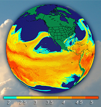
Atmospheric rivers are responsible for most of the global moisture moving from the tropics to the extratropics. They contribute significantly to the global climate and hydrological cycle and represent a leading cause of flooding in the mountainous regions of the western U.S. To improve modeling of atmospheric rivers, Department of Energy scientists at Pacific Northwest National Laboratory investigated the sensitivity of atmospheric river frequency simulated by a global climate model to grid resolutions and dynamical cores. The researchers analyzed aquaplanet (all ocean) simulations using the Community Atmosphere Model version 4 (CAM4) at 240, 120, 60 and 30 km model resolutions each with the Model for Prediction Across Scales (MPAS) and High-Order Methods Modeling Environment (HOMME) dynamical cores. They found that the frequency of atmospheric river events decreases with model resolution and the HOMME dynamical core produces more atmospheric river events than MPAS. When they compared the frequencies by accounting for differences in large-scale conditions, they found that the changes in atmospheric river frequency is related to the overall sensitivity of sub-tropical westerlies, atmospheric precipitable water content and profile, and to a lesser extent, extratropical Rossby wave activity, to model resolution and dynamical core. They found similar model resolution dependence in real-world simulations performed by MPAS at 120 and 30 km grid resolution using realistic configuration and sea surface temperatures. Compared to the NCEP2 global reanalysis, the MPAS real-world simulations underestimate atmospheric river frequencies at both resolutions. This may be related to the climatologically drier sub-tropics and the poleward shifted jets simulated by the model. The study highlights important links between model climatology of large-scale conditions and extremes, and motivates the need to better understand their relationships and improving model simulation of the large-scale circulation.
This research is based on work supported by the U.S. Department of Energy Office of Science Biological and Environmental Research as part of the Regional and Global Climate Modeling Program. Computing resources for the model simulations are provided by the National Energy Research Scientific Computing Center (NERSC).