
Spatially Resolved Modeling of Flow in Artificially Drained Agricultural Watersheds
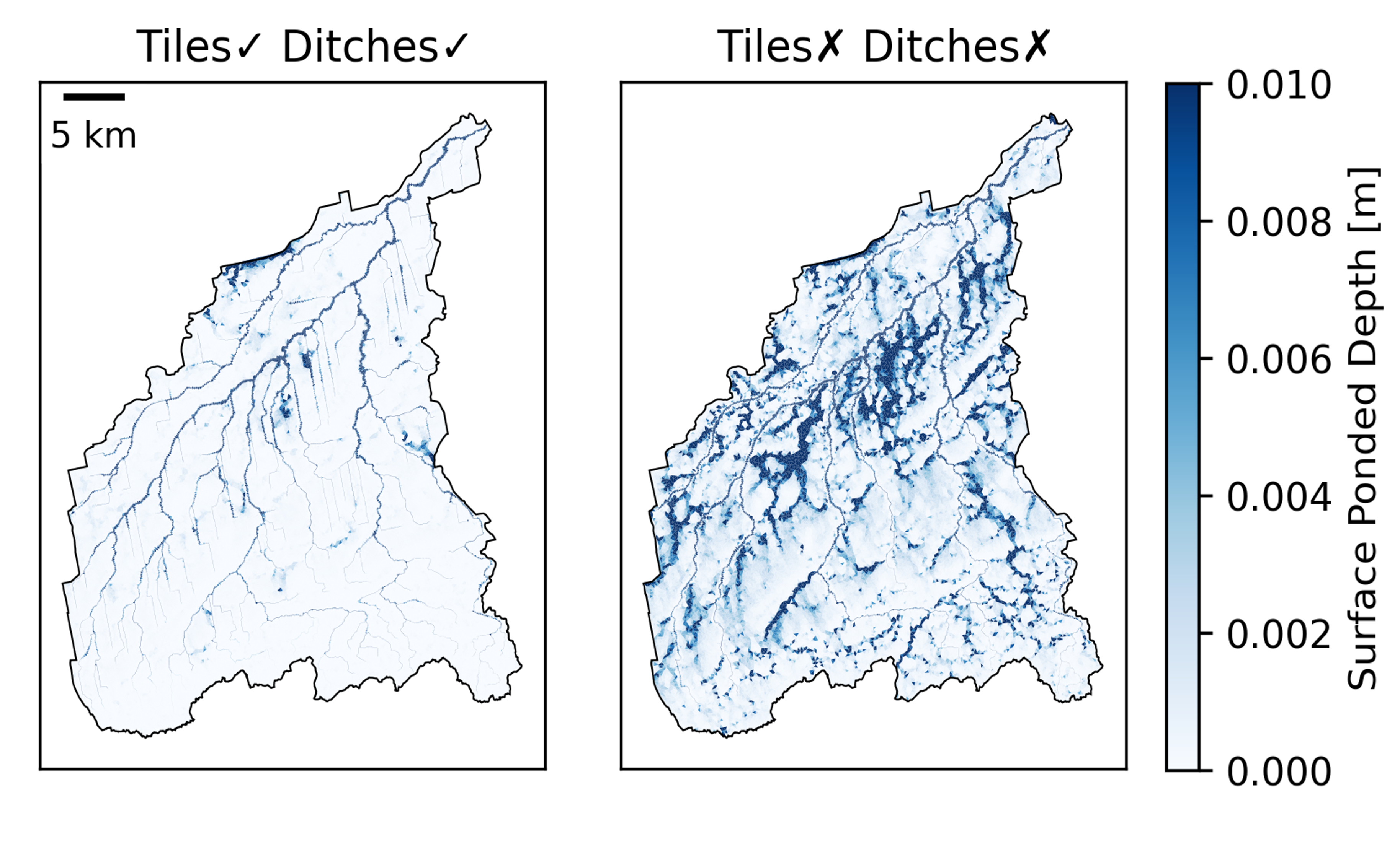
Surface water ponding in the Portage River Watershed, OH, as simulated by the ATS model with (left) and without (right) artificial drainage.
Image by the authors
Farmers often rely on subsurface tile drains and surface ditches to control water levels and prevent fields from flooding. However, these artificial drainage systems can have unintended consequences downstream, negatively impacting water quality and aquatic ecosystems. Accurately representing these systems in large-scale watershed models has been a significant challenge for scientists. Our study addresses this by developing new methods to represent ditches and tile drains. Using these new techniques, we successfully simulated how drainage systems influence water movement. The simulations reproduced streamflow in a large agricultural watershed and significantly outperformed traditional models that require extensive fine-tuning.
Our novel approach to modeling artificial drainage systems in agricultural watersheds reduces the need for site-specific fine-tuning, making the models more reliable for studying the impacts of climate change. This advancement enhances our ability to study how water and nutrients move through watersheds, offering better tools for managing water resources, controlling nutrient runoff, and understanding the impacts of climate change on agricultural landscapes.
Artificial drainage systems, such as subsurface tile drains and surface ditches, play a crucial role in the hydrology of agricultural watersheds but are difficult to represent accurately in large-scale models. Our study implemented these systems in the DOE-developed ATS integrated hydrology simulator using explicit mesh refinement for surface ditches and physically based subgrid models for tile drains. This model accurately reproduced observed streamflow in the Portage River Watershed in Ohio, covering over 1000 square kilometers, without requiring site-specific fine-tuning. It significantly outperformed a widely used semi-distributed model that required heavy calibration. The new spatially resolved modeling approach has strong physical underpinnings, which reduces the need for calibration and improves confidence in projections. This high-resolution simulation capacity enables a new generation of models for studying watershed-scale hydrological responses and nutrient transport, especially in the context of a changing climate.