
Exploring a Multi-resolution Approach Using AMIP Simulations
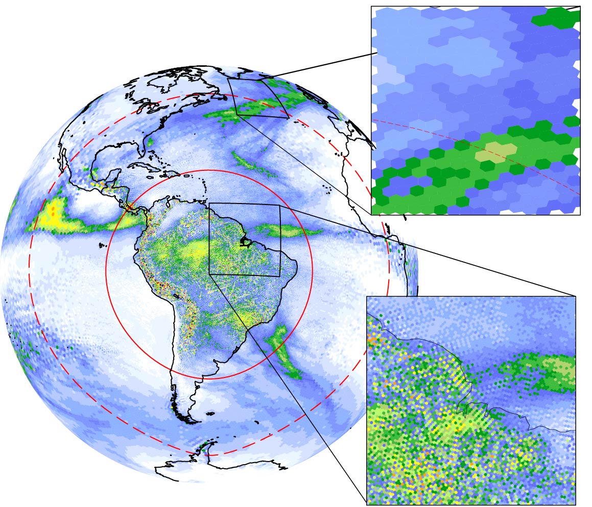
Reliable prediction of climate at a regional scale can inform decisions on climate mitigation and adaptation. However, a higher grid resolution is needed to represent complex surface conditions and small-scale atmospheric phenomena that influence regional climate. This is too computationally demanding for long-term and ensemble global simulations, but two-way interactions between the regional and global climate are important and best realized by global models. New-generation models such as the Model for Prediction Across Scales - Atmosphere (MPAS-A) with "multi-resolution" grids are able to simulate the climate over target regions with finer resolution, while a coarser grid is used to cover the rest of the globe to reduce computational cost. Department of Energy scientists at Pacific Northwest National Laboratory worked together with collaborators from Los Alamos National Laboratory, University of Delaware, Auburn University, and National Center for Atmospheric Research to test the usefulness of this multi-resolution approach by MPAS-A for regional climate modeling. By carefully evaluating the multi-resolution MPAS-A simulations against a reference simulation on a globally high-resolution grid, as well as several observational data sets, they found that MPAS-A is able to well reproduce the reference simulation in the high-resolution region, particularly when the refinement is focused over the equatorial South America. In addition, increasing resolution produces higher quality simulations compared to observations. Improved climate features include the amount and spatial distribution of seasonal precipitation, the probability distribution of daily precipitation rates, large-scale atmospheric moisture transport, and surface evaporation. These findings demonstrate the importance for models to increase grid resolution to capture the interactions between the atmosphere and the underlying land surface with land-sea contrasts, mountains and valleys, and heterogeneous land-cover that interact with the atmosphere to produce regional climate features.
This study was supported by the U.S. Department of Energy (DOE) Office of Science Biological and Environmental Research as part of the Regional and Global Climate Modeling program. The research used computational resources from the National Energy Research Scientific Computing Center (NERSC), a DOE User Facility supported by the Office of Science under Contract No. DE-AC02-05CH11231. Additional computational resources were provided by the Pacific Northwest National Laboratory (PNNL) Institutional Computing program. The FV-CAM4 data were provided by the earth system grid data portal from the National Center for Atmospheric Research (NCAR), which is supported by grants from the National Science 773 Foundation. The authors wish to thank Dr. Travis O’Brien of Lawrence Berkeley National Laboratory for facilitating the use of the model data archive at NERSC. We also thank Drs. Jin-Ho Yoon, Matus Martini, Phil Rasch, and Hailong Wang for their insights provided through discussions. The thorough review and constructive comments by two anonymous reviewers are also greatly appreciated. PNNL is operated for DOE by Battelle Memorial Institute under contract DE-AC05-76RL01830.